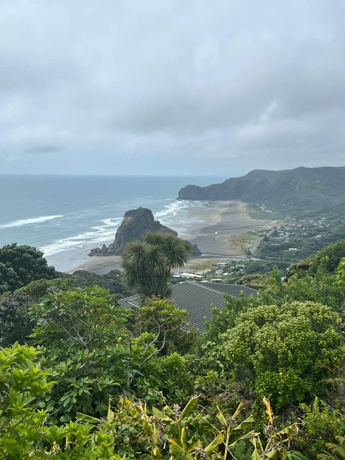
Classic profile
South Piha beach
In front of the surf club
- Best forThe lion shape
- LightLate afternoon
- NearbySurf club, village
Your stop on the map
View 25 stops
Choose a route, then tap a pin or stop for its note and a Google Maps link.
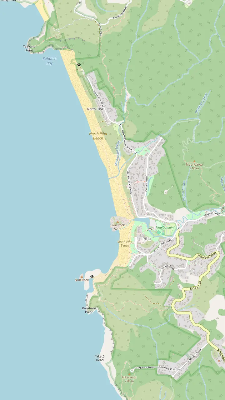
A volcanic neck with a lion-shaped profile; its summit track is closed.
Google MapsRock island at the south end of the beach, cut by a sea tunnel.
Google MapsSea channel among arches and blowholes; reachable from the beach at low tide only.
Google MapsLifeguards since 1934; swim between the red and yellow flags.
Google MapsThe lifeguard service on the northern beach.
Google MapsClifftop track above South Piha, closed with three large slips.
Google MapsThe southern half of the beach, between Lion Rock and Taitomo Island.
Google MapsThe quieter northern half of the beach, beyond Lion Rock.
Google Maps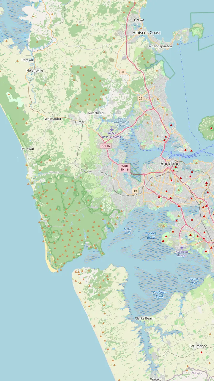
The drive west starts here; the regional park is a 40-minute drive from the city center.
Google MapsThe last village before the forest, where Scenic Drive begins its climb into the ranges.
Google MapsThe ranges' visitor center at 300 Scenic Drive, free to enter, with a viewing deck and track advice.
Google MapsThe narrow, winding road down from the ridge to the coast; allow extra time.
Google MapsThe village store and café, a short walk from the southern beach.
Google Maps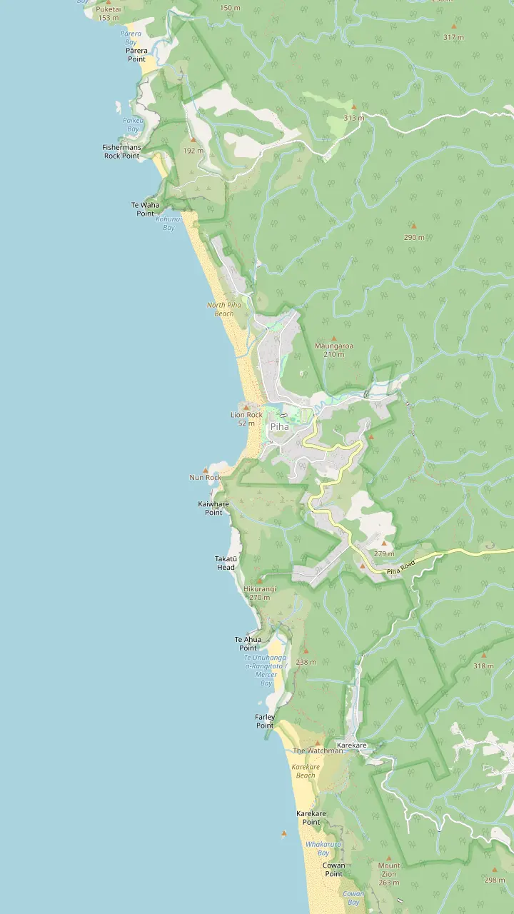
The village store and café, a short walk from the southern beach.
Google MapsThe campground beside the stream, between the village and the beach.
Google MapsThe quieter northern half of the beach, beyond Lion Rock.
Google MapsThe neighboring beach to the south, with a waterfall a few minutes inland.
Google MapsA small cove north of North Piha, reached on foot.
Google Maps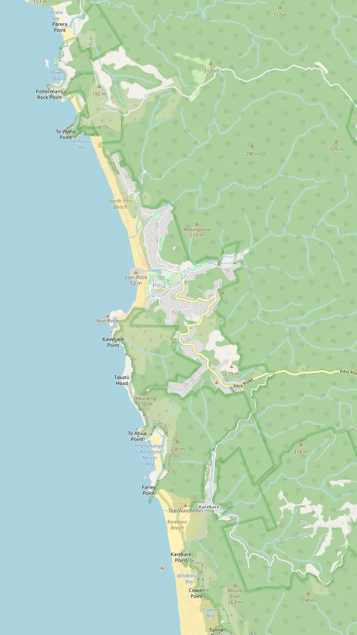
A tiered waterfall of about 40 metres, roughly 30 minutes' walk from the start.
Google MapsThe road inland from the village toward the start of the falls track.
Google MapsLinked to the falls loop; a new boardwalk and bridge are funded.
Google MapsClifftop circuit to Te Ahua headland; best walked clockwise.
Google MapsPā site marked by a pou, important to Te Kawerau ā Maki.
Google MapsStart of the Mercer Bay Loop, where a radio station once stood.
Google MapsRestored track from the Mercer Bay junction down to Karekare Beach; a steep climb back.
Google MapsA short walk inland from Karekare Beach.
Google MapsClifftop track above South Piha, closed with three large slips.
Google MapsOnly the upper section, Anawhata Road to Te Waha, is open.
Google MapsBase map © OpenStreetMap contributors
Lion Rock at Piha rises from the black sand in the middle of the bay. This guide covers how it formed, why the track to the top is closed, the surf club that grew up beside it and good places to see it from.
Editorial team, pihabeachtour.click · Updated November 8, 2026 · ~7 min read
Quick look
Every photograph of Piha seems to include it: a dark, steep-sided rock standing on the sand where the beach bends, with surf breaking on its seaward face. Auckland Council's planning schedule of outstanding natural features ranks Lion Rock among the region's iconic landforms: a big rocky stack whose outline resembles a lion.1 Tourism New Zealand calls it a small island standing mid-beach.6
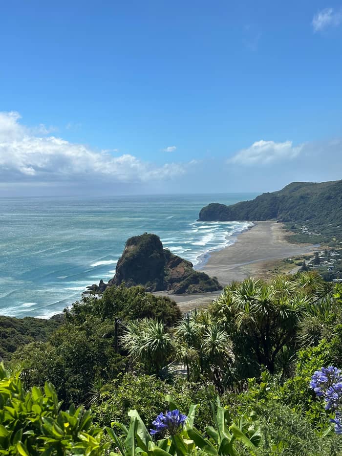
Island or headland, the rock is above all a divider, splitting the shore into beaches of different character: the regional tourism agency notes that it separates Piha's southern surf beach from North Piha.2 South of it lies the busier beach with the surf club and the village; north of it the sand runs on toward a quieter stretch backed by dunes and bush.
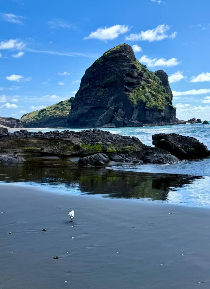
Which side looks most like a lion depends on where you stand. From the southern beach near the surf club, the rock reads as a crouching animal facing the sea, with a raised head and a long back. From North Piha the outline is blunter. Walk a slow arc along the sand in late afternoon and you can watch the profile appear, sharpen and fade again as the light moves across the cliffs behind it.
The rock at a glance
| Feature | What it is | Can you visit? |
|---|---|---|
| Lion Rock | Volcanic neck with a lion-shaped profile1 | Base only; summit track closed3 |
| The Gap | Sea channel among arches and blowholes9 | From the beach at low tide10 |
| Taitomo Island | Rock with a sea tunnel cut through it9 | View from the beach |
| Tasman Lookout Track | Clifftop track above South Piha | Closed, repairs due in the first half of 202711 |
| Piha Surf Life Saving Club | Lifeguards since 19345 | Clubhouse with bar and restaurant12 |
Status as Auckland Council gives it in its October 2026 update; check the council's track map before you go.4
Lion Rock is the inside of a volcano that has lost its outside. According to the regional tourism agency, it is the worn-down neck of a volcano whose eruptions ended many millions of years ago.2 A volcanic neck is the plumbing: the vent through which material rose. When the softer cone around it wore away, the harder fill of the vent was left standing.
The council's geological description is precise about that fill. It records a volcanic neck packed with a wide range of eruption and erosion products, cut through with andesite intrusions.1 Look at the rock's base at low tide and you can see the mix: angular chunks of different colors set in a darker matrix, the kind of jumble an eruption leaves behind when it plugs its own throat.
The same volcanic history shapes the south end of the beach. The council's schedule names Nun Rock, Taitomo Island, The Gap and the nearby cliffs as the finest current example of sea arches and blowholes anywhere on the Northland and Auckland west coast, with tunnels cut through the rock by the sea.9 Lion Rock is the showpiece, but the whole bay is a cross-section through an old volcanic landscape being worn back by the Tasman.
The rock through time
Long ago
A volcano erupts and its vent fills with debris.2
Since then
The cone wears away and leaves the hard neck standing.1
1934
Lifeguards organize on the sand in front of the rock.5
2023
Storms badly damage walking tracks across west Auckland.7
October 2026
Next
Geotechnical, engineering and heritage work is funded.8
Not at present. Auckland Council's page on west Auckland park projects, last updated in October 2026, states that the Lion Rock Track is closed because the land is unsafe and unstable.4,3 Many tracks in the west were badly damaged by the storms of 2023, and the council is working through the repairs gradually.7 Respect any closure signs or barriers you meet.
Repairing it is not a simple job. The council says money has been set aside to assess geotechnical risks, look at engineering solutions, protect the track's cultural heritage and check that any work fits the Waitakere Ranges Heritage Area Act 2008 and the Regional Parks Management Plan 2022.8 That list explains the pace: the rock is a protected landscape and a place of cultural importance, not just a viewpoint with a broken path.
You may still read older descriptions of the climb. The Auckland tourism agency's landmark page describes a short, steep path to a stone seat that marked the highest point allowed.15 Treat that as history until the council reopens the track. The council's status is what counts on the day, and its walking-track map is the place to check before you go.16
Plan around the rock
Start from what brought you to the rock.
If I wanted to climb it
See it from the sand instead
The council lists the track as closed.3
If I love geology
Study the base at low tide
The neck is packed with eruption debris and andesite.1
If I want to reach The Gap
Go along the beach at low tide
The clifftop route is closed.10
If I want a sunset photo
Stay into the evening
The tourism agency suggests timing a visit for sunset.13
If I want to swim nearby
Stay between the flags
Lifeguards warn of a rip north of the rock.14
Where to look from
Classic profile
In front of the surf club
Wide view
The quieter half of the beach
Close up
On the sand at low tide
The Waitakere coast is not an empty wilderness. At the Te Ahua pā site on the Mercer Bay walk just south of Piha, the regional tourism agency notes that Te Kawerau ā Maki are the iwi who hold authority over the land.26 At the Arataki Visitor Centre an 11m carved kauri pou shows the iwi's ancestors and affirms their guardianship of the forest of the ranges.30 Lion Rock sits inside that landscape.
Respect here is practical as well as polite. Since December 2017 a rāhui laid by Te Kawerau ā Maki has protected the Waitakere forest against kauri dieback, and Auckland Council backs it with track closures.31 When a council plan for Lion Rock lists cultural heritage beside engineering, it is a reminder that what happens to the rock is not decided by engineers alone.8
For a visitor that means a few simple habits. Stay off closed paths and fenced areas, including the rock itself. Do not climb on carvings or markers if you see them on the coast. Keep the beach clean and take rubbish away with you. If a sign or a local asks you to keep away from a particular place, do so without needing a reason. You will not miss much: the rock looks its best from the sand.
The surf lifesaving story of Piha is told at the rock's feet. Piha Surf Life Saving Club was established in 1934, and it credits the iron sands facing Lion Rock as the birthplace of many of its groundbreaking initiatives.5,32 The club also describes itself as marking 90 years of lifeguarding.33 Its clubhouse stands on the southern beach, facing the rock across the sand.
The club is known well beyond the beach. It says it enjoys possibly the highest profile in the country, thanks to a top-rating television program and to the sheer number of people on a beach it rates among the country's busiest patrolled.34 Its surfboat crews compete at the top level at home and abroad, and its junior program takes children from age 5 through to 14, when they move on to train as lifeguards.35,36
For visitors the club's key work is simple: the red and yellow flags it sets up mark the area it watches most closely, and it asks everyone to swim between them.22 The clubhouse also has a bar, a restaurant and a hostel, which makes it a useful stop for a sunset drink with a view of the rock.12
Video
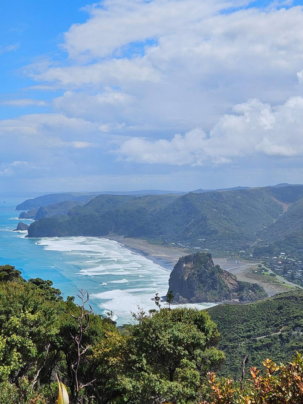
Cai and Dee on YouTube · The video waits until you tap play to load.
Lion Rock is a large rocky stack with a lion shaped profile, and is one of the region's iconic landforms.
Before you go
Lion Rock does more than decorate the view. It shapes the surf, and lifeguards know its currents well. In a rescue report from November 2025, Surf Life Saving New Zealand describes the rip north of Lion Rock as heading straight out to sea.14,37 On that evening a surfer was pulled by a rip near the rock and drifted about 1.5 km before a police helicopter found him.37
He was spotted at the southern end of South Piha, a long way from where he had been surfing, still on his board after more than an hour in the water.38 The lesson for anyone on the beach is that water moving around a large rock can carry you a long way quickly. If you are not a confident surfer, admire the rock from the sand and swim only in the flagged area.
South of the rock, the cliffs hold their own hazard. The council says the track to the Tasman Lookout above Piha is closed with three large slips, and that The Gap can only be reached from the beach at low tide.10 It expects the lookout repairs to be finished in the first half of 2027.11 Until then, plan any walk to The Gap around the tide, and turn back early if the water is rising.
Ask why Piha beach is famous and the rock is a big part of the answer. It is the shape that identifies the place at a glance, the backdrop to the surf club and the dividing line between the beaches. Add black volcanic sand, a powerful surf and a village tucked into bush, and you have a scene that the national tourism body describes as popular with experienced surfers and families having picnics under the eye of the surf club.39
The surf is part of the fame. The surf club ranks the break among the best known in the country.40 The national tourism body, for its part, warns of strong, often dangerous currents, with a flagged stretch watched by lifesavers through summer.41 Lion Rock stands right between the patrolled southern beach and the long northern sand.
Getting there is straightforward with a car, and a guided half-day trip is the easy option without one. The tour sold on this site takes 5 hours from Auckland with pickup and includes Piha's black sand among its stops, along with bush tracks in the Waitakere Ranges. It costs from $118. For a view of Piha beach and Lion Rock at sunset, which the regional tourism agency recommends, a private tour or your own car gives you control of the clock.13
FAQ
Auckland Council's natural features schedule describes its lion-shaped profile.1
The national tourism body calls it a small island, set mid-beach.6
The council has funded geotechnical, engineering and heritage assessments but gives no reopening date.8
Lifeguards describe a rip north of the rock that heads straight out to sea.14
Sources
Black sand, rainforest or the surf? A real person answers here.