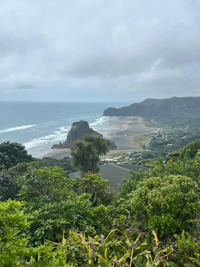
Waterfall walk
Kitekite Falls
Bush walk to a tiered fall
- StartGlenesk Road
- TimeAbout 60 minutes
- GroundGravel, boardwalk, stairs
Your stop on the map
View 25 stops
Choose a route, then tap a pin or stop for its note and a Google Maps link.
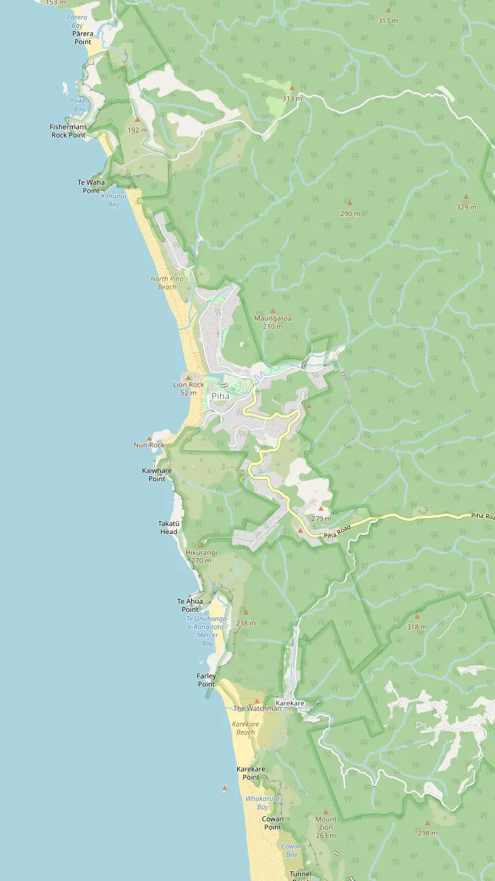
A tiered waterfall of about 40 metres, roughly 30 minutes' walk from the start.
Google MapsThe road inland from the village toward the start of the falls track.
Google MapsLinked to the falls loop; a new boardwalk and bridge are funded.
Google MapsClifftop circuit to Te Ahua headland; best walked clockwise.
Google MapsPā site marked by a pou, important to Te Kawerau ā Maki.
Google MapsStart of the Mercer Bay Loop, where a radio station once stood.
Google MapsRestored track from the Mercer Bay junction down to Karekare Beach; a steep climb back.
Google MapsA short walk inland from Karekare Beach.
Google MapsClifftop track above South Piha, closed with three large slips.
Google MapsOnly the upper section, Anawhata Road to Te Waha, is open.
Google Maps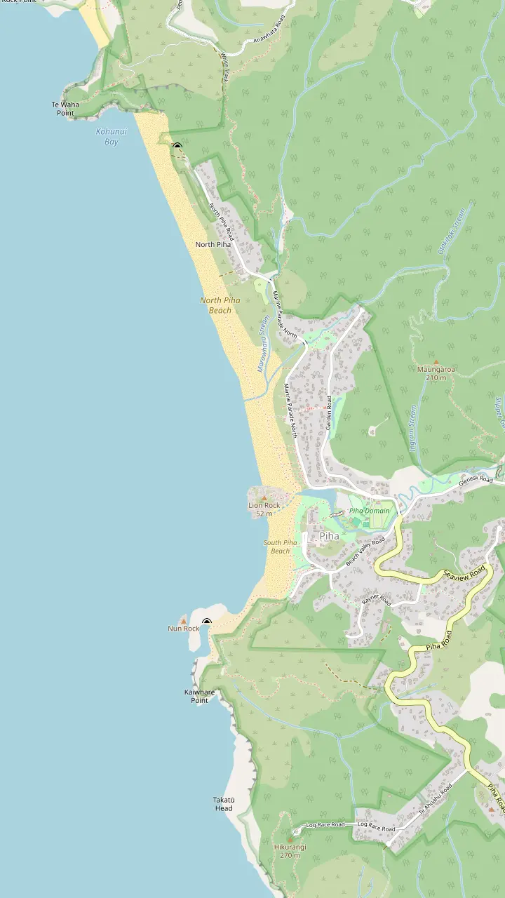
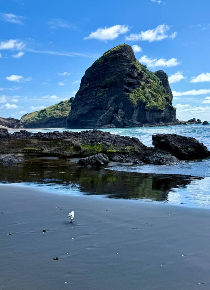
A volcanic neck with a lion-shaped profile; its summit track is closed.
Google MapsRock island at the south end of the beach, cut by a sea tunnel.
Google MapsSea channel among arches and blowholes; reachable from the beach at low tide only.
Google MapsLifeguards since 1934; swim between the red and yellow flags.
Google MapsThe lifeguard service on the northern beach.
Google MapsClifftop track above South Piha, closed with three large slips.
Google MapsThe southern half of the beach, between Lion Rock and Taitomo Island.
Google MapsThe quieter northern half of the beach, beyond Lion Rock.
Google Maps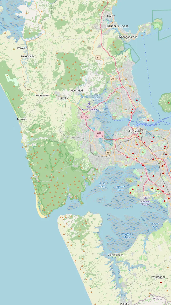
The drive west starts here; the regional park is a 40-minute drive from the city center.
Google MapsThe last village before the forest, where Scenic Drive begins its climb into the ranges.
Google MapsThe ranges' visitor center at 300 Scenic Drive, free to enter, with a viewing deck and track advice.
Google MapsThe narrow, winding road down from the ridge to the coast; allow extra time.
Google MapsThe village store and café, a short walk from the southern beach.
Google Maps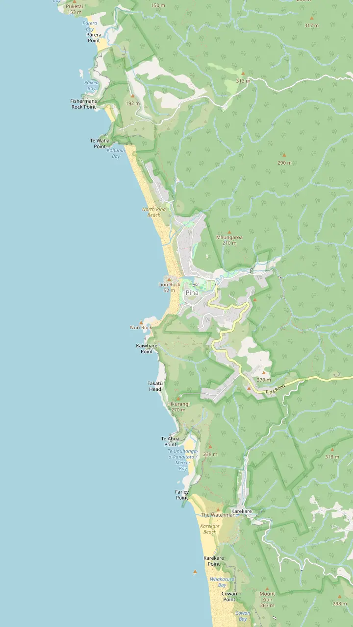
The village store and café, a short walk from the southern beach.
Google MapsThe campground beside the stream, between the village and the beach.
Google MapsThe quieter northern half of the beach, beyond Lion Rock.
Google MapsThe neighboring beach to the south, with a waterfall a few minutes inland.
Google MapsA small cove north of North Piha, reached on foot.
Google MapsBase map © OpenStreetMap contributors
The classic walks near Piha Beach start a few minutes from the sand. Here is how to reach Kitekite Falls, walk the Mercer Bay clifftops, find Karekare Falls, and which tracks the council still has closed.
Editorial team, pihabeachtour.click · Updated November 8, 2026 · ~7 min read
Quick look
Kitekite is the classic waterfall near Piha Beach, and the regional tourism agency calls the path a must-do when in Piha.7 The falls drop about 40 meters in a series of tiers into a pool ringed by bush, and Tourism New Zealand notes the old kauri trunk at the start of the walk.8 On a still day you hear the water before you see it.
The falls are a geological feature as well as a pretty one. Auckland Council's schedule of outstanding natural features lists Kitekite among the highest and most easily reached falls in the Waitakere Ranges, pouring over a cliff of Piha Formation volcanic conglomerate with dikes visible in the rock face.9 The dikes are the darker, near-vertical bands: old cracks that filled with molten rock.
What makes the walk special is how fast the beach disappears. Within minutes you trade surf noise for birdsong, nīkau palms and tree ferns. The track is short enough for a family outing and varied enough to feel like a real walk in the bush, with boardwalks, stairs and stream crossings. It suits walkers who are steady on their feet and happy with some uneven ground.
Walks compared
| Walk | Start | Time or length | Status |
|---|---|---|---|
| Kitekite Falls | Glenesk Road | About 60 minutes2 | Open16 |
| Mercer Bay Loop | Log Race Road3 | 2.2km or 2.3km by source17,18 | Check the council map |
| Karekare Falls | Karekare | A few minutes19 | Check the council map |
| Tasman Lookout Track | South Piha | Short clifftop track | Closed, repairs due 202720 |
| Lion Rock Track | Lion Rock | Short, steep | Closed4 |
| Laird Thomson Track | Anawhata Road | Upper section only | Partly open21 |
Status from Auckland Council's projects page, last updated October 2026; times from the regional and national tourism agencies.22
The route from Piha Beach to Kitekite Falls heads inland up Glenesk Road from the village toward the start of the track. From there the regional tourism agency says you can reach the 40-meter falls in roughly 30 minutes on an easy, gradual climb, and its free-activities guide allows about 60 minutes for the track overall.1,2 Add time for photos, a picnic and the walk from wherever you parked.
The path was upgraded to protect kauri from dieback and now runs on formed gravel and boardwalks that suit moderate fitness.11 The tourism agency also warns of several stream crossings and stairs that can be awkward for less mobile walkers.13 After heavy rain, stick to the tracks and boardwalks and do not try the stream crossings.12 Good shoes with grip matter more than speed.
Phone coverage is patchy in the valley, so take a photo of the track map at the start before you set off.10 The agency also suggests arriving early for soft morning light through the trees.14 On a hot day it recommends a dip in a cascade pool; check the water is calm, keep children close and stay away from the lip of each tier.15
On the Kitekite path
At the start
Setting off
A landmark at the start of the walk.8
On the way
A gradual climb through bush.11
Streams
Skip the crossings after heavy rain.12
About 30 minutes
A tiered drop of about 40 meters.1
Return
The full track takes about 60 minutes.2
Every walk in these hills starts with the same routine. Auckland Council asks track users to make sure shoes and equipment carry no visible soil and to use the hygiene stations at track entrances and exits.6 The reason is kauri dieback, a soil-borne disease spread by a pinhead of mud.24 Scrub, spray, walk, and never step off the formed track onto roots.
Storm damage is the other reason to check before you go. The council says the 2023 storms left many west Auckland tracks needing to be rebuilt, a job it is doing in stages.25 At Kitekite the news is good: all storm-damaged tracks at the falls are open again.16 More work is funded, including a new boardwalk and bridge to give safe access across the lower slip and stream to Knutzen Track.26
The council keeps a live map of open and closed walking tracks and asks visitors to check it before visiting a regional park.27 Its projects page was last updated in October 2026, and conditions can change after heavy rain, so treat any list here as a snapshot.22 If a sign at the start says a track is closed, it is closed, whatever an older guide or app may tell you.
Choose your walk
Time, legs and the view you want decide it.
If I have an hour
Kitekite Falls
About 60 minutes for the track.2
If I want sea views from high up
Mercer Bay Loop
The highest coastal slopes in Auckland.23
If I have a pushchair or bad knees
A short beach walk instead
Kitekite has stairs and stream crossings.13
If It rained heavily last night
Stay on boardwalks
Avoid the stream crossings after heavy rain.12
If I want The Gap
Walk the beach at low tide
The clifftop track is closed.5
Pick a walk
Waterfall walk
Bush walk to a tiered fall
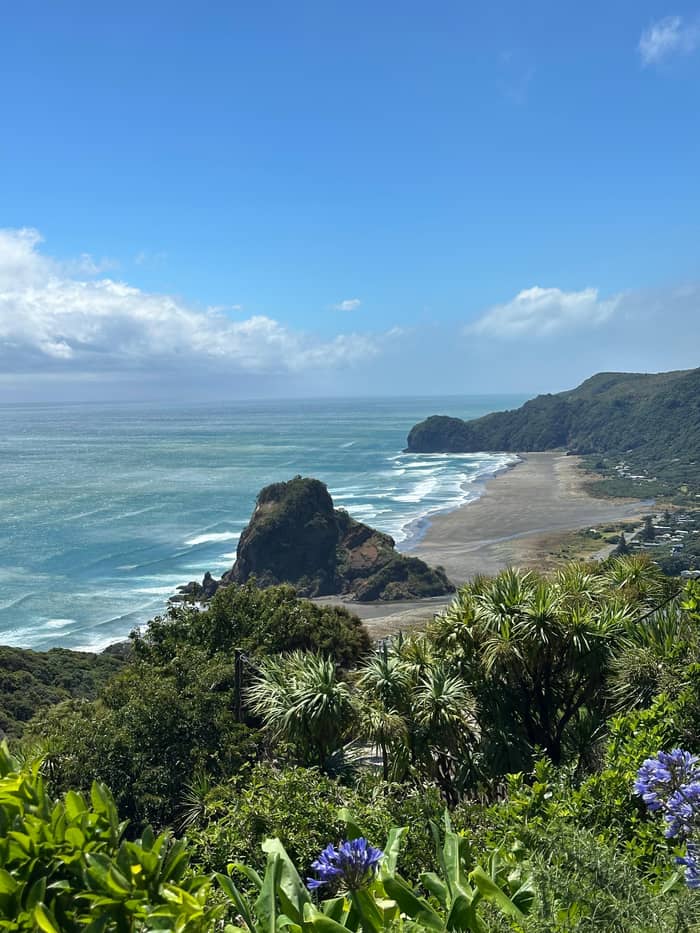
Coastal views
Clifftops above Piha
Quick stop
Short walk at the next beach
For a completely different mood, drive up to Log Race Road above the southern end of Piha. The regional tourism agency says the Mercer Bay Loop starts there, where a radio station once stood, and that the loop flows best clockwise from the southern side of the car park.3,37 Public toilets sit by the car park at the start.40
The track leads out to Te Ahua headland, where a pou marks a pā site of great importance to Te Kawerau ā Maki, whose authority over this land the agency acknowledges.38 A small platform at the end looks north and south along the coast.41 Tourism New Zealand describes these as the highest coastal slopes in Auckland, and the drop to the sea is dramatic.23 Stay on the track and behind barriers.
Sources differ slightly on the length: Tourism New Zealand gives 2.3km, while the regional tourism agency gives 2.2km with steep sections and exposed ridges.18,17 Either way it is short but sharp. At the junction, the left fork drops down the restored Comans Track to Karekare Beach, a steep climb back.39 The agency suggests finishing around sunset for the light over Piha.42
Some famous viewpoints are out of bounds for now. The Piha Beach lookout on the cliffs above the southern beach is Tasman Lookout. Auckland Council lists the Tasman Lookout Track as shut, blocked by three large slips; until it reopens, the sand at low tide is the only way to The Gap.5 It expects the repairs to be completed in the first half of 2027.20
Lion Rock's summit track is closed too, with the council citing unsafe and unstable land.4 North of the village, only the upper section of the Laird Thomson Track, from Anawhata Road to Te Waha, is open; a large slip closes the rest, with work also due in the first half of 2027.21 None of these closures stops you enjoying the beach, but they do shape the day.
If you came for a high view, the Mercer Bay Loop is the open alternative on the southern cliffs, and the drive down Piha Road gives a sweeping view of the bay from above. For The Gap, plan your beach walk for low tide and check the tide before you set out, since the council says the beach route works only at low tide.5 The council's map is the final word on what is open on the day you visit.27
Video
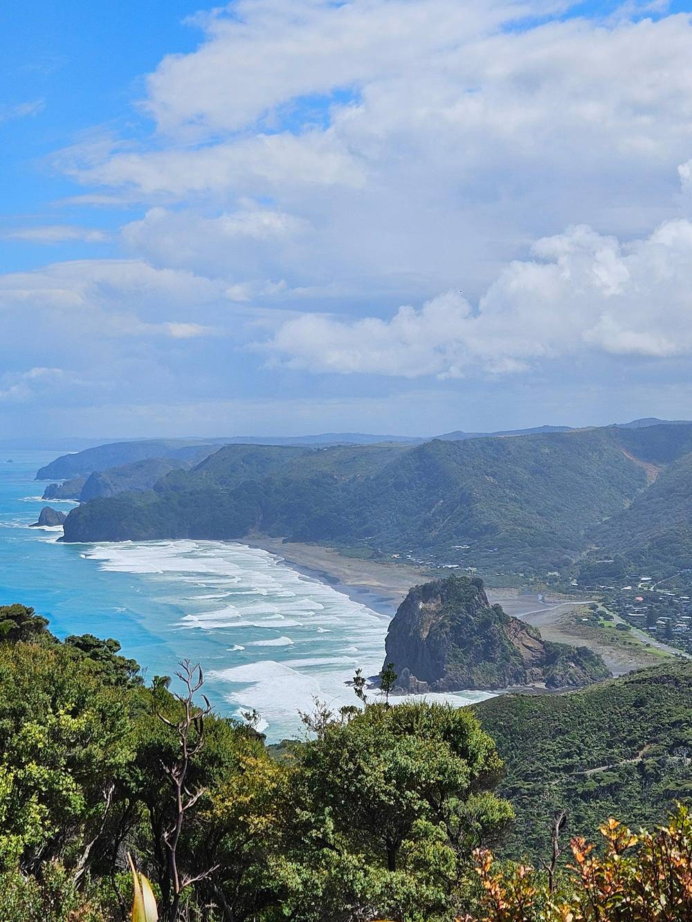
New Zealand Walking Tours on YouTube · The video waits until you tap play to load.
All storm-damaged tracks at Kitekite Falls are now open.
Pack for the bush
Next door to Piha, Karekare has a waterfall of its own. Tourism New Zealand says Karekare Falls are just a few minutes' walk inland from the beach, which was made famous by the film The Piano.19 It is a short stop that pairs well with a Piha day if you have a car, and the winding drive between the beaches is part of the experience.
For bigger days, the Waitakere Ranges have over 250 kilometers of walking tracks, according to Tourism New Zealand.43 An example it gives is the Upper Huia Reservoir walk, 17 kilometers past an old mine, dams and nīkau palms.44 A number of tracks remain closed for kauri protection, so long routes need more planning than the short Piha walks.45
The easiest place to plan is the Arataki Visitor Centre on Scenic Drive, on the way out from Auckland. The regional tourism agency suggests checking current track conditions with the staff there, cleaning footwear at every hygiene station and staying on open tracks.46 Ask the staff which open tracks fit your time, your fitness and the day's weather.
Without a car, a guided trip saves the logistics. A listing called Explore Black Sand Piha Beach and Water Falls in West Auckland stops at Piha Beach and then Kitekite Falls, where the walk is self-guided within a time limit set by the guide, over stairs, rocks and natural surfaces. It lasts 4 hours with pickup, from $126.
The tour this site sells does not list Kitekite; its walking is on rainforest bush tracks instead. Its program fills a half-day of 5 hours: pickup in Auckland, rainforest bush tracks, time on Piha's black sand and afternoon tea in the kiwi style, at a pace for all fitness levels. It costs from $118.
A private 7-hour tour adds Karekare Falls and an optional Mercer Bay loop to Piha and Arataki, from $188. Whichever you choose, wear shoes with grip, bring a light rain layer and water, and expect to clean your footwear at the kauri stations before and after every walk.6
FAQ
Auckland Council confirms the Kitekite Falls tracks hit by storms have all reopened.16
The tourism agency suggests a dip in a cascade pool; take care on wet rock.15
Sources
Black sand, rainforest or the surf? A real person answers here.